Pulled Over on the Side of Route 9 With a Map the Size of a Bedsheet: What GPS Quietly Took From Us
Somewhere in America right now, there is a person who cannot tell you which direction is north. They are standing in a parking lot, staring at their phone, rotating it slightly to make the little blue arrow line up with the street they're looking for. They are not embarrassed by this. They have never needed to know which direction is north. The phone always knows.
Thirty years ago, this person would have been considered lost. Today, they're just navigating.
The Art of the Pre-Trip Briefing
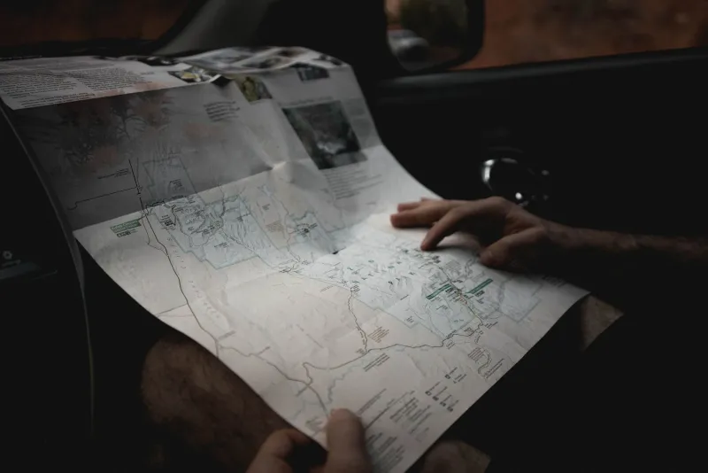
Before GPS, before MapQuest, before any of it, going somewhere new required preparation. Real preparation. You pulled out the road atlas — that thick, spiral-bound Rand McNally that lived in the back seat like a fifth passenger — and you studied it. You traced the route with your finger. You noted the highway numbers, the exits, the towns you'd pass through as landmarks. You might even write it down on a piece of paper and tape it to the dashboard.
If you were heading somewhere really unfamiliar, you called ahead. The person you were visiting would give you directions the old way: "Take 95 north to exit 14, then turn left at the Sunoco, go about two miles, and we're the third house after the Methodist church. You can't miss it." You always could miss it. But you wrote it down anyway.
Gas stations sold folded state maps for a dollar or two. Glove compartments across America were stuffed with them — some current, some hopelessly outdated, a few from states you'd driven through once in 1987 and never thought about again. Unfolding one on the hood of a car in a rest stop parking lot was a completely normal activity that nobody photographed for social media because social media didn't exist and also it wasn't remarkable. It was just what you did.
Getting Lost Was Part of the Trip
Here's the thing about getting lost that nobody talks about anymore: it was often fine. Sometimes it was better than fine.
You'd miss your exit and end up in a town you'd never heard of and stop for lunch at a diner that turned out to be excellent. You'd take a wrong turn and stumble onto a two-lane road that wound through countryside you'd never have seen otherwise. You'd ask a stranger for directions and end up in a ten-minute conversation about local history that you still remember thirty years later.
Getting lost built something. It built spatial reasoning — the mental map that humans develop when they're forced to pay attention to where they are relative to where they've been. It built confidence, because you got un-lost, repeatedly, and you learned that being lost wasn't a crisis. It built the quiet satisfaction of figuring something out without being told the answer.
None of this is available on Google Maps.
The Stranger You Had to Ask
Asking for directions used to be a social transaction that happened millions of times a day across America. You'd pull up to a gas station, roll down your window, and ask the attendant how to get to wherever you were going. Or you'd approach someone in a parking lot. Or lean out of your car to flag down a pedestrian.
This required a certain social bravery that seems almost quaint now. You had to admit you didn't know something. You had to trust a stranger's knowledge. And the stranger, almost always, tried to help — drawing little maps on napkins, walking you to the corner to point you in the right direction, debating with their coworker about whether the shortcut through the industrial park was actually faster.
These were micro-connections. Small, human, unremarkable moments of one person helping another person get somewhere. They happened constantly, and then they almost entirely stopped.
What the Blue Line Replaced
GPS navigation arrived in consumer vehicles in the early 2000s and became genuinely ubiquitous with the smartphone era — really, with the launch of Google Maps navigation around 2009. Within a few years, the road atlas had migrated from back seat to garage sale table.
The technology is, by any objective measure, extraordinary. Real-time traffic data. Rerouting around accidents. Accurate arrival times. The ability to find a specific address in a city you've never visited without a single moment of uncertainty. It is one of the most practically useful technologies ever handed to ordinary people.
And it has made many of us genuinely worse at knowing where we are.
Studies on spatial navigation have found that heavy GPS reliance is associated with reduced hippocampal activity — the part of the brain involved in building cognitive maps. People who navigate by GPS develop less detailed mental maps of areas they travel through regularly compared to people who navigate independently. In plain terms: the more you let the phone think for you, the less your brain practices thinking for itself.
Beyond the neuroscience, there's something simpler. When a voice tells you to turn right in 400 feet, you don't need to understand where you are. You just need to follow instructions. The landscape outside your window becomes scenery rather than information. You stop reading the road.
The Accomplishment of Arrival
There was a specific feeling that came with successfully navigating somewhere unfamiliar using only a map and your own judgment. A quiet pride. You'd planned it, you'd executed it, you'd made the right calls at the confusing intersections, and now you were here. You'd earned the destination.
That feeling is largely gone. When your phone tells you that you've arrived, you've followed instructions successfully. That's different from having figured something out. It's the difference between solving a puzzle and being handed the solution.
None of this means GPS is bad. It means, as with most technology, that what we gained came with something attached. We got certainty. We lost a little competence. We got efficiency. We lost a certain kind of adventure.
Somewhere out there is a folded road atlas with coffee rings on the cover and a highlighted route through the Smoky Mountains from a family trip in 1994. Whoever planned that trip knew something the phone doesn't — that the point was never just to arrive.